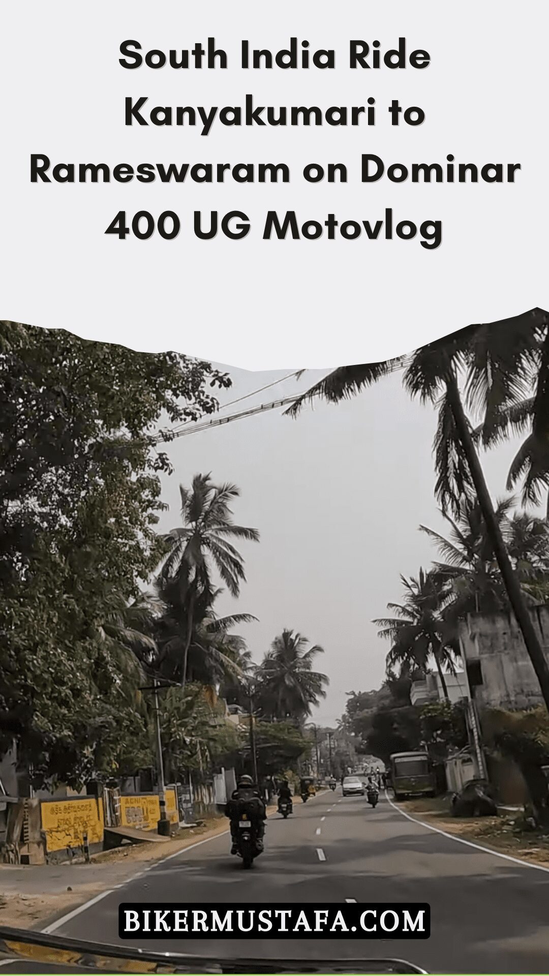
South India Ride Kanyakumari to Rameswaram on Dominar 400 UG Motovlog [S1-Ep12]
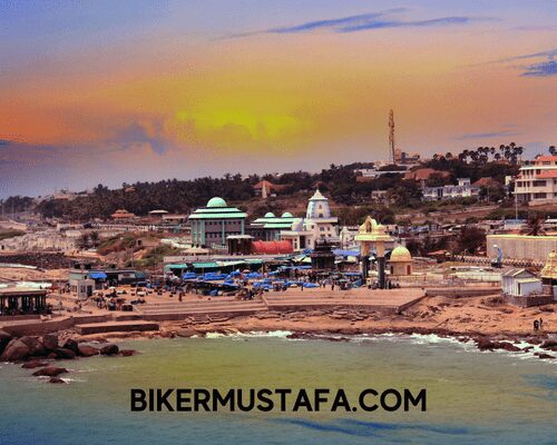
The city of Kanniyakumar, also known as Cape Comorin, is located in the Kanniyakumari district of the Indian state of Tamil Nadu. The name refers to Devi Kanya Kumari, popularly known as “The Virgin Princess.” It is known as “The Land’s End” since it is the southernmost city on the Indian mainland and the southernmost point of the Indian subcontinent. The city is located around 20 kilometres (12 miles) south of Nagercoil, the administrative centre of the Kanniyakumari district, and 90 kilometres (56 miles) south of Thiruvananthapuram city.
In India, Kanniyakumari is a well-known tourist resort and site of pilgrimage. Its distinctive dawn and sunset locations, the 41-meter-tall (133-foot) Thiruvalluvar Statue, and the Vivekananda Rock Memorial off the coast are popular tourist attractions. The Laccadive Sea surrounds the town, located at the very tip of peninsular India on all sides save the east and west. On its three sides is a 71.5 kilometre (44.4 mi) long stretch of coastline.
A shrine honouring Goddess Kanniyakumari (the virgin Goddess), after whom the town is called, is located on the city’s coastlines. Since the Sangam era, Kanniyakumari has existed as a city and has been mentioned in ancient Malayalam literature and the writings of Ptolemy and Marco Polo.
History
Etymology
The location gets its name from the Goddess Kanya Kumari, who is regarded as Krishna’s sister. Women visit the goddess’ temple to pray for marriage since it is thought she may free them from mental stiffness. Portuguese Ceylon was taken from the Portuguese East Indies by the Dutch East India Company in 1656. Over time, the name became distorted to “Comorin,” and during British control in India, it was known as Cape Comorin. The governments of India and Madras later changed the city’s name to Kanniyakumari.
Legend
Hindu mythology states that Shiva was supposed to marry Kanya Devi, an avatar of Parvati. However, Shiva did not appear on his wedding day. The uncooked and unused rice and other grains from the wedding feast remained. With time, the uncooked grains grew into stones. Some people think the small stones on the shore now, which resemble grains of rice, are pieces of the unofficial wedding. Today, Kanya Devi is revered as a virgin goddess who bestows blessings on the town’s crowds of visitors and pilgrims.
In the Hindu Shaktism tradition, her temple in Kanniyakumari is a Shakti Peetha or holy shrine. Another Hindu myth states that during the Ramayana War, Hanuman was transporting a mountain with his life-saving herb, Mrita Sanjivani, from the Himalayas to Lanka (Sri Lanka). Marunthuvazh Malai, which translates to “hills where medicine lives,” is given to this land. This is considered to be the cause of the region’s rich local diversity in medicinal plants. On the Kanniyakumari-Nagercoil route, Marunthuvazh Malai is close to Kottaram, around 7 kilometres (4 mi) from the town of Kanniyakumari. It is thought that long ago, in the area of this location, resided the sage Agasthya, who was an expert in medicinal plants. It is also thought to cause abundant medicinal plants on the hills close to Kanniyakumari. Tourists travel to the heart of the hill, where there is an ashram, to visit the ashram and get a sight of the sea at Kanniyakumari, a few kilometres away.
Geography
At 8.08°N 77.57°E, Kanniyakumari has an average elevation of 30 metres. The Laccadive Sea encircles Kanniyakumari’s peninsular tip on three sides. The Western Coastal and Eastern Coastal Plains meet there, making this location.
The Indian Subcontinent’s southernmost point, Kanniyakumari, is located at the southernmost extremity of the continent. As a result, it is now included in the standard Hindustani expression “Kashmir se Kanniyakumari,” which refers to the length of India. Before the partition, the expression in undivided India was “Khyber se Kanniyakumari.” However, the Republic of India’s southernmost point is Indira Point on Great Nicobar Island, located at 6°45’10″N and 93°49’36″E. The closest city is Thiruvananthapuram, Kerala, which is 85 km (53 mi) away. Thiruvananthapuram International Airport is the closest airport, while Nagercoil, the administrative centre of the Kanniyakumari District, is the closest town, located 22 km (14 km) away.
Prominent Landmarks
Statue of Thiruvalluvar

The 29-meter-tall (95-foot) Thiruvalluvar Statue is supported on a rock that is 11.5 metres (38 feet) tall and depicts the Thirukkural’s 38 chapters of “virtue.” The figure atop the rock symbolises “wealth” and “pleasures,” denoting that love and fortune should be achieved and enjoyed based on strong virtue. [16] The Thirukkural contains 133 chapters, and the statue and pedestal measure 133 feet (40.5 metres) tall together. It weighs 7000 tonnes in total. The statue resembles Nataraja in a dance position. It was sculpted by the same Indian artist who made the Iraivan Temple, V. Ganapati Sthapati. Its official opening took place on January 1, 2000. The Indian Ocean tsunami struck the monument on December 26, 2004. However, it was unharmed. High-magnitude earthquakes won’t destroy the statue. Tourist access is impeded during repair procedures and when the water is turbulent.
Vivekananda Memorial Rock
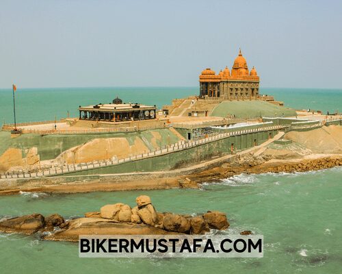
In Vavathurai, Kanniyakumari, India, there is a well-known tourist attraction called the Vivekananda Rock Memorial. A memorial can be found on two rocks roughly 500 kilometres (310 miles) east of Vavathurai’s mainland. In honour of Swami Vivekananda, who is supposed to have reached enlightenment atop the rock, it was constructed in 1970. Local lore claims that Goddess Kumari practised asceticism on this rock. The memorial also has a meditation room (Dhyana Mandapam) for guests. The mandapa’s design blends various types of temple architecture from across India. It has a Vivekananda statue inside. The Laccadive Sea encircles the cliffs. The Vivekananda Mandapam and the Shripada Mandapam are the memorial’s two primary buildings.
Mandapam in honour of Gandhi
On the site where the urn carrying the Mahatma’s ashes was kept for public inspection before immersion, the Gandhi Memorial Mandapam was constructed. The memorial, shaped like a Hindu temple in central India, was made in such a way that on Gandhi’s birthday, October 2, the sunrise will directly hit the spot where his ashes were interred.
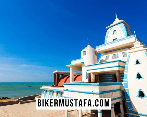
Memorial Park for the Tsunami
A memorial to those lost in the 2004 Indian Ocean earthquake and tsunami, an underwater megathrust earthquake that killed some 280,000 people worldwide, including India, Sri Lanka, Somalia, Thailand, the Maldives, and Indonesia, is located close to Kanniyakumari.
Temple of Bhagavathy Amman
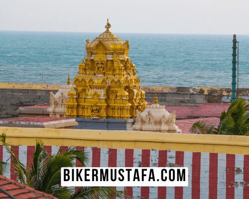
Goddess Kumari Amman is the subject of the 3,000-year-old Bhagavathy Amman Temple, situated at Kanniyakumari. One of Devi’s incarnations is Kumari Amman, sometimes called “Kumari Bhagavathy Amman.” The first Durga temple built by Lord Parasurama is the Kumari Bhagavathy Amman temple, one of the 108 Shakthi Peethas. This temple is located on the Laccadive Sea’s coast. The Ramayana, the Mahabharata, and Purananooru refer to the Kumari temple.
Monument to Kamarajar Mani Mantapa
The Kamarajar Mani Mantapa Monument was built and honoured Mr Kamarajar, an Indian National Congress president and former Tamil Nadu chief minister. He is also commonly referred to as “Black Gandhi” by the general public. Kamarajar’s ashes were held in this location, similar to the Gandhi Mantapa, so that people might pay their respects before submerging in the sea.
Tourism
Ferry services between the town and the Vivekananda Rock Memorial and Thiruvalluvar statue on rocky islets off the coast are provided by the state-owned Poompuhar Shipping Corporation. The ferry service started running in 1984. Until June 2013, two ferries were utilised to transport tourists, but in honour of Swamy Vivekananda’s 150th birthday, a third ferry was added to the schedule. Nearly all major Indian towns have direct train connections with Kanniyakumari and the neighbouring Nagercoil. Thiruvananthapuram International Airport is the closest airport, located 70 miles (43 kilometres) from Nagercoil and 90 miles (56 kilometres) from Kanniyakumari Town. Chennai is about 744 kilometres (462 mi) from Kanniyakumari.
People Also Ask:
What is Kanyakumari famous for?
Because it is the only location on earth where you can witness the Sun Rise and Sun Set from the ocean, Kanyakumari is well-known. On full moon days, it is the only location in India where one may witness the extraordinary spectacle of the Sun Setting and Moon Rising at the Same Time.
Is Kanyakumari worth a visit?
Tourism in Kanyakumari has profited from the city’s unique spiritual significance. Since it is believed to be the residence of the virgin Goddess Kanya Kumari, it is a well-known pilgrimage site. The town is a great place to go on your next vacation because it offers amenities for people of many faiths.
Is Kanyakumari part of Kerala?
The current Kanyakumari region was still a part of Kerala’s Trivandrum district in July 1949, when the United States of Cochin and Travancore were established.
Is one day enough for Kanyakumari?
Most of Kanyakumari’s attractions may be seen in a single full-day tour. You will be picked up in the morning from your hotel or house in Kanyakumari and dropped off in the evening as part of your guided one-day local sightseeing tour in a car.
Mountains in Kanyakumari district.
At the southernmost edge of the Western Ghats on NH 47, Marunthuval Malai—a nearly naked peak with an elevation of 800 feet—can be found by taking a detour through the village of Pothaiadi, which is located around 11 kilometres from Nagercoil and 7 kilometres from Kanyakumari.
Recommended Articles:
South India Ride Bangluru to Mysore Motovlog
South India Ride Hubli to Bangaluru Motovlog
3 thoughts on “South India Ride Kanyakumari to Rameswaram on Dominar 400 UG Motovlog”